


A group of technological solutions related to the area of widely understood spatial information management, geoscience and geospatial intelligence.
We are not closed to conventional out-of-the-box GIS-class solutions which, despite having a multitude of functions, must be adapted to the customers’ expectations anyway. Our solutions include mostly products implemented on an on-demand basis, integrated and configured for a specific set of functionalities, for specific functional requirements and quality requirements of the customer.
Big Data Solutions
We build solutions based on the platform for managing, processing, analysing and visualising very large volumes of spatial data. By applying a unique combination of the big data technology within the spatial context, we can efficiently merge and analyse countless amounts of vector data, raster data, point clouds and other types of data.
The technology stack is based on Apache (Hadoop, Spark, Ranger, Accumulo, Cassandra, HBase, etc.), commercial software and developed extensions supporting distributed data processing and parallel data processing within the spatial context.
We also offer support in selecting certified hardware to be used with the components of the above-mentioned platform.
Data Processing, Data Analysis and Data Visualisation
- GeoARA
GeoARA platform is our own integrated set of software components, developed for the purposes of complying with the full scope of requirements of GIS users and other users. All the components form one integrated GIS ecosystem.
GeoARA platform allows for integration of advanced domain applications with spatial data originating from various sources within one descriptive and mapping view, ensuring simultaneous viewing and editing of spatial data and descriptive data.
The platform features embedded mechanisms for capturing (extracting), processing, analysing and visualising data. Moreover, GeoARA supports advanced management of user rights at the level of an individual attribute, whereby the management is related to both the business layer and the data repository.
The platform consists, among other things, of the following:
GeoARA WebGIS
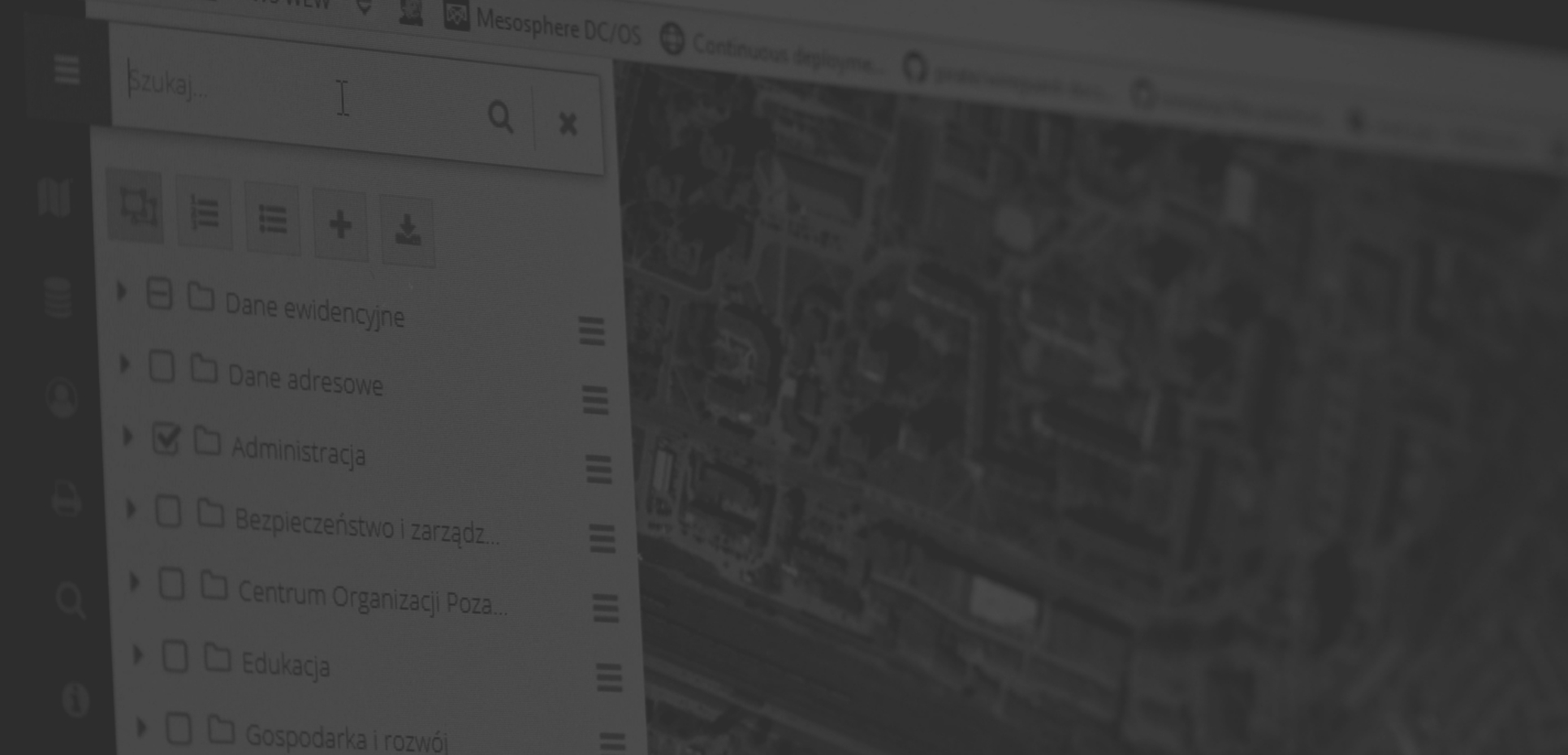
GeoARA WebGIS is a map portal targeted at institutions and companies having spatial data which they want to present to a wider community of users, as well as to entities searching for analytical solutions oriented towards spatial information. The portal is operated by means of a web browser and does not require installation of any additional tools on the user’s computer.
GeoARA Server
GeoARA Server is a server-based application providing access to spatial data in the form of OGC and REST web services. The crucial feature of the system is handling numerous sources of data, including Oracle MS SQL or PostgreSQL databases, but also data stored and processed in the so-called Big Data tools. The application is capable of handling both vector data and raster data, as well as point clouds originating from various sources. Furthermore, GeoARA Server allows for making spatial data available in the form of web services: WMS, WFS, WCS, TMS, WMTS and others.
GeoARA Reports
GeoARA Reports is a component intended for creating and generating statements and reports concerning the data stored in the system or derived from external sources.
GeoARA Integrator
GeoARA Integrator is based on the enterprise service bus and ensures access to a set of tools allowing for safe and flexible integration with domain systems, data sources, authentication services, document repositories, etc. The component allows for constructing systems and integration with external systems in accordance with the SOA concept.